

The next day, the morning drizzle gives way to low cloud by the time I set off from Ubuntu, for the drive to Tidal River.
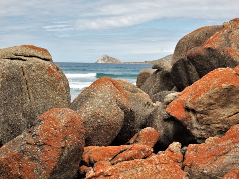
It makes the light too flat and diffuse for photographs, but I pull in at Whiskey Bay and climb over orange lichen covered rocks to get the best out of the colours in the sun’s absence. Ahead of me, Norman Island is a rocky outcrop across the sea.
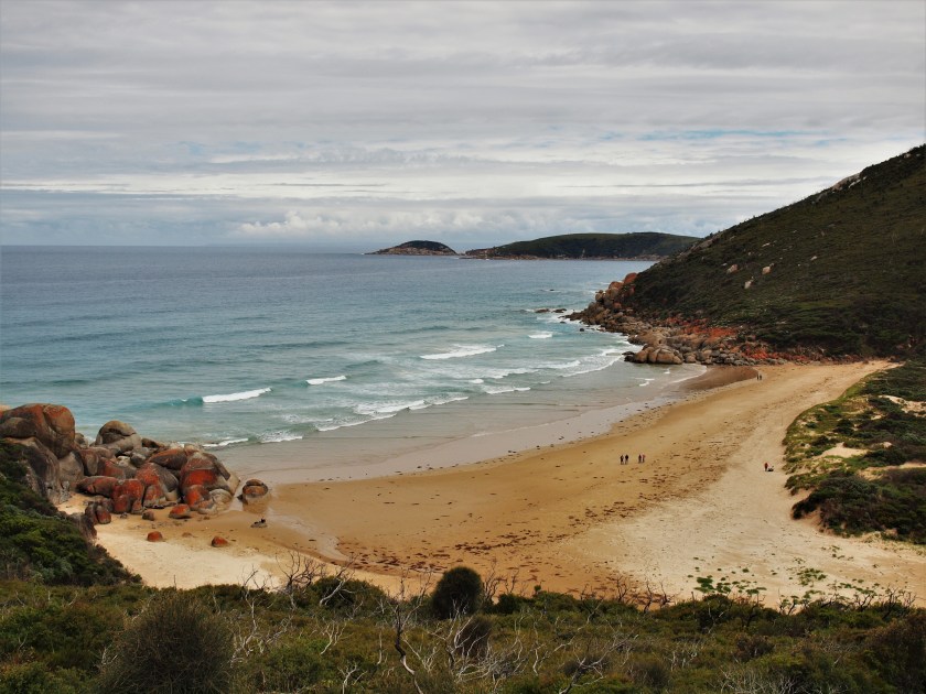
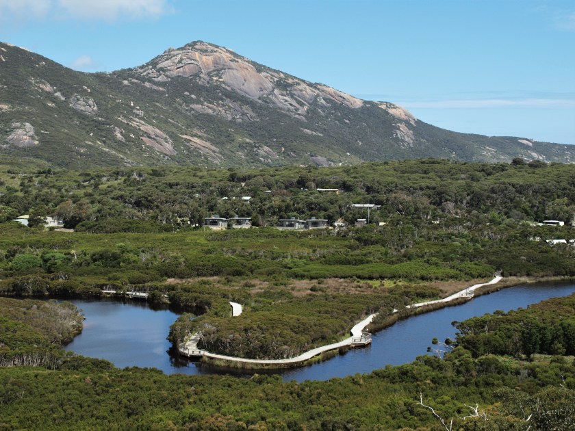
I’m not sure about the weather today, so I opt for a walk from Tidal River, taking the Tidal Overlook Circuit (3.8km, 1.5hrs) that climbs steadily from the footbridge across the tidal inlet. It has the best views of the campsite, of the place where it nestles between the two Points that bracket Norman Beach.
As the path rises I can look back at the campground in miniature, surrounded by dense bush far below.
The air becomes muggy as the day warms, and when the track starts to loop around to a high point, I can see the Lilly Pilly carpark far below, and the small clearing it inhabits in this solid wilderness. It looks like a tiny dugout, a naked spot amongst the trees. It looks like it could be taken back so easily, grown-over and forgotten.

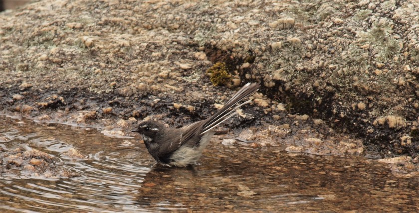
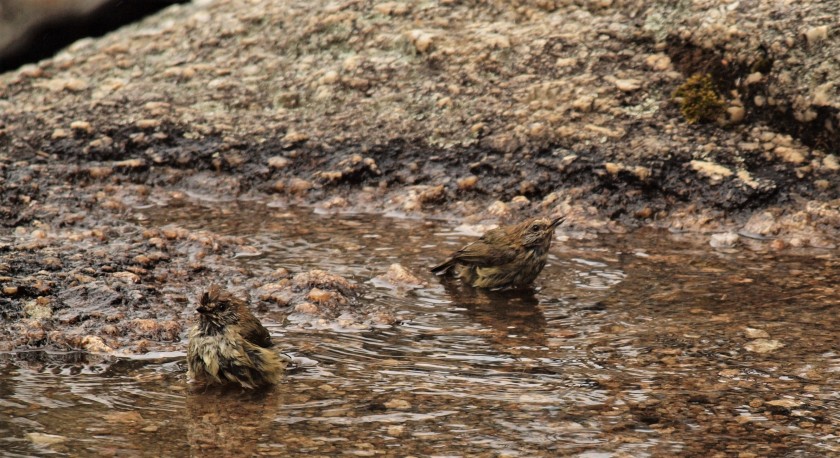
I come across some birds bathing in a rock pool, and watch them in the emerging sunshine before descending to a connecting track that leads me back to Tidal River.
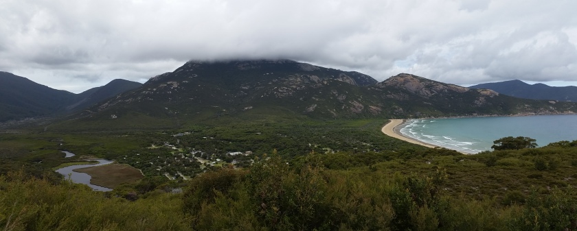
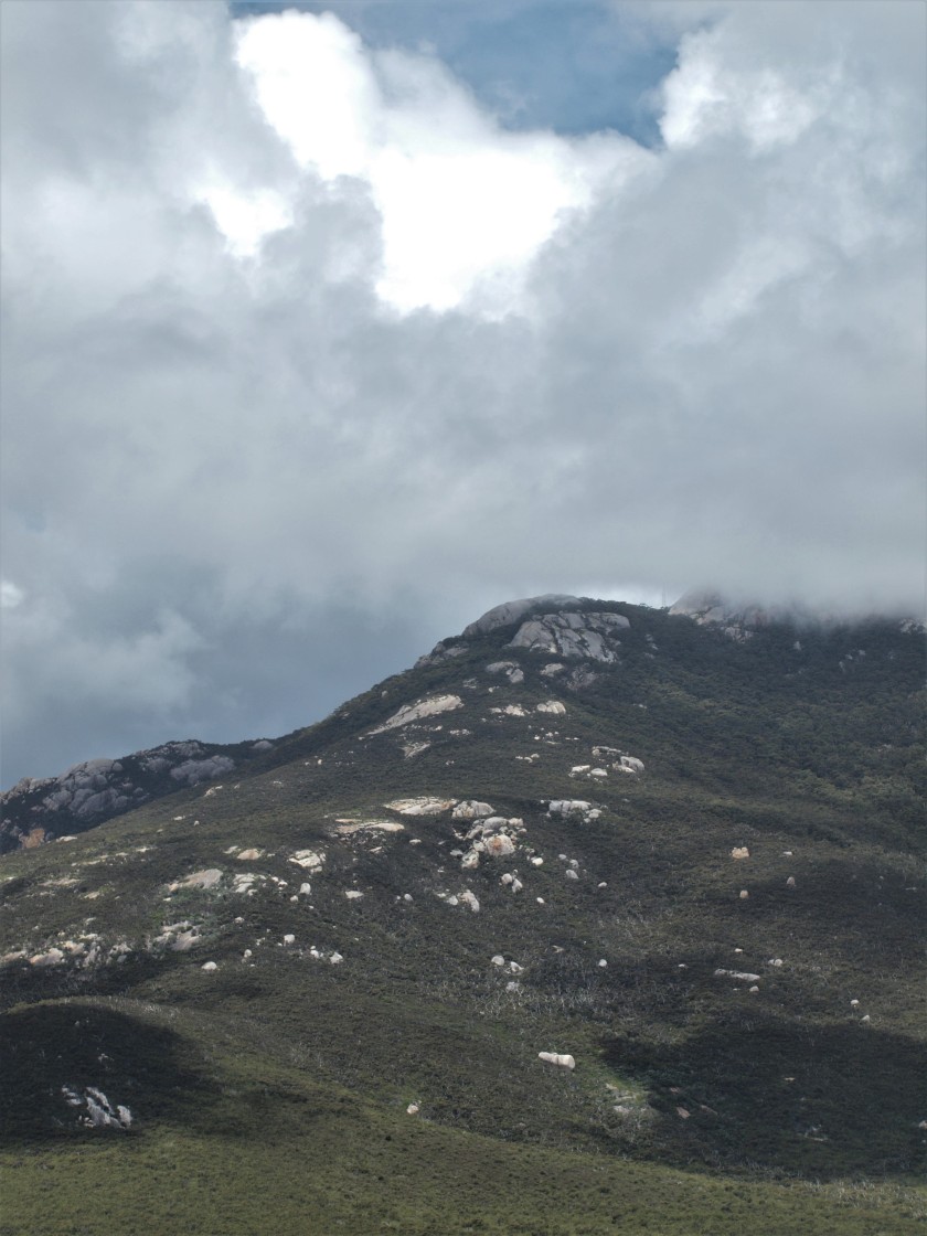
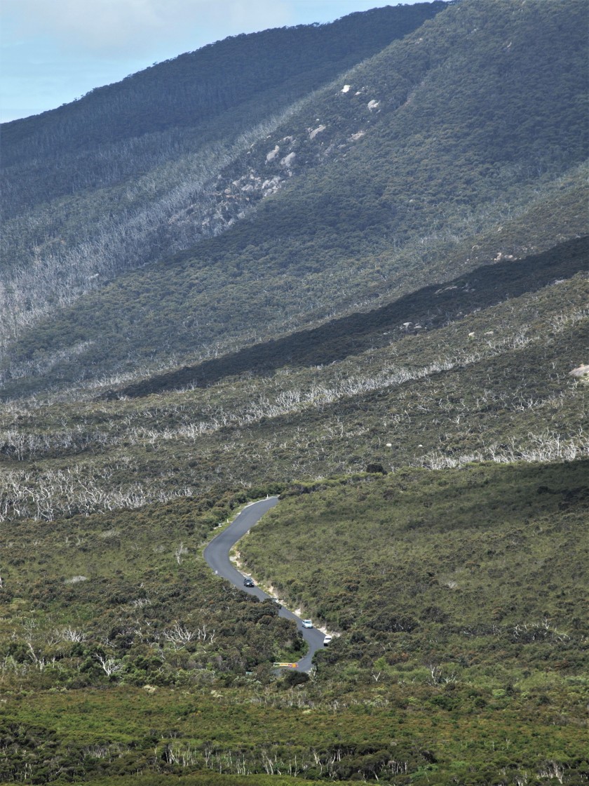
Clouds are shrouding the hill peaks, cars are snaking down the road from Telegraph Saddle, and I can see the wooden slats of the boardwalk following the banks of the river below me.
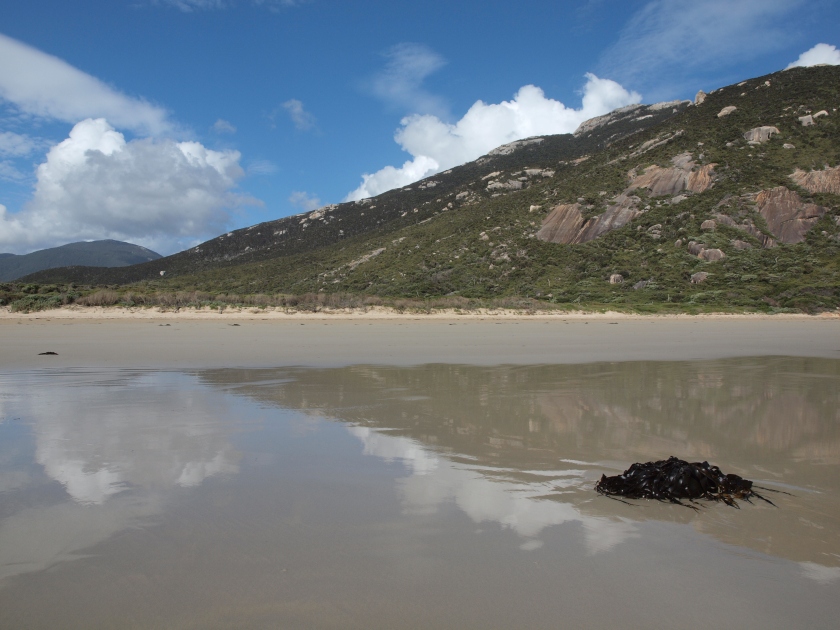
Once I’ve crossed the footbridge again, I take the boardwalk, the Loo-Errn Track (1km) around duck filled wetlands before a final walk on Norman Beach.
It’s difficult to leave The Prom in the late afternoon. The isolation here is very calming. Admittedly, you can add to your provisions at the store, and there’s drinking water available, but there’s no fuel on-site. There’s a need to be very self-sufficient, to be prepared for anything: a change in weather, protection from heat or cold, from sun or rain, enough to eat and drink. It simplifies everything. Brings it all back to existence and survival. You might be able to buy your coffee here at the café, but the reality is, we’re 37km from the nearest town (Yanakie). I could easily imagine this place cut-off from the world, and without supplies I wonder how long we’d survive. This wilderness would easily outlast us, swallow up our walking tracks and delete us.
**
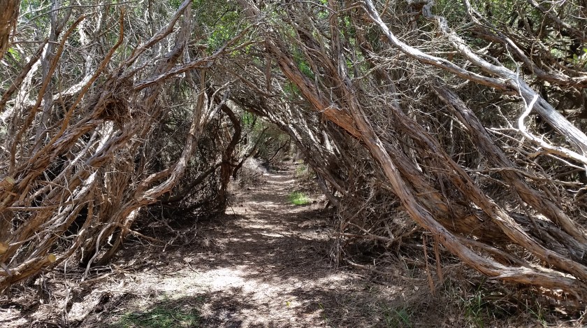
I take a short walk before I leave on my final morning – the 2km Duck Point Loop Track from Foley Rd – which passes through bird filled trees flitting in the canopy above me. From a tree lined tunnel of interlaced branches I emerge to a long walkway of pink flowers growing amongst the fleshy succulents that form the ground cover on the sand.


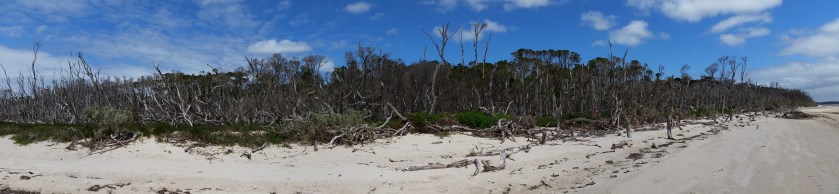
The path takes me to a beach of dead trees, silver trunks, and blanched driftwood. The clusters of dead stumps stretch around the headland, stark and dramatic in the bright sunlight and I try to imagine their story, how they ended up in this still life. Their beautiful twisted shapes are on my mind as I begin the journey back along the South Gippsland Highway.
My visit to Prom Country has only been an introduction to its wild shores and boisterous weather, and the notion of leaving brings on an unexpected sense of loss that I carry with me like a stone in my chest. I draw on my memories of the last few days as I drive northwards, towards the big city again. The roaming wildlife and the cicada hum in the air, the fickle winds and changeable weather, the chance to stand alone on a walking track in the wilderness and hear nothing but the click of insects around me in the hush.
There can be no better sense of peace. I know I’ll have to return.
